Are you ready for a new era of toll collection in India? Starting May 1, 2025, the country is set to launch a GPS-based tolling system that aims to replace the existing FASTag method. While this new system promises to streamline toll collection and reduce traffic congestion at toll plazas, it has also been met with criticism and concerns. Let’s take a closer look at the pros and cons of India’s upcoming GPS-based toll system.
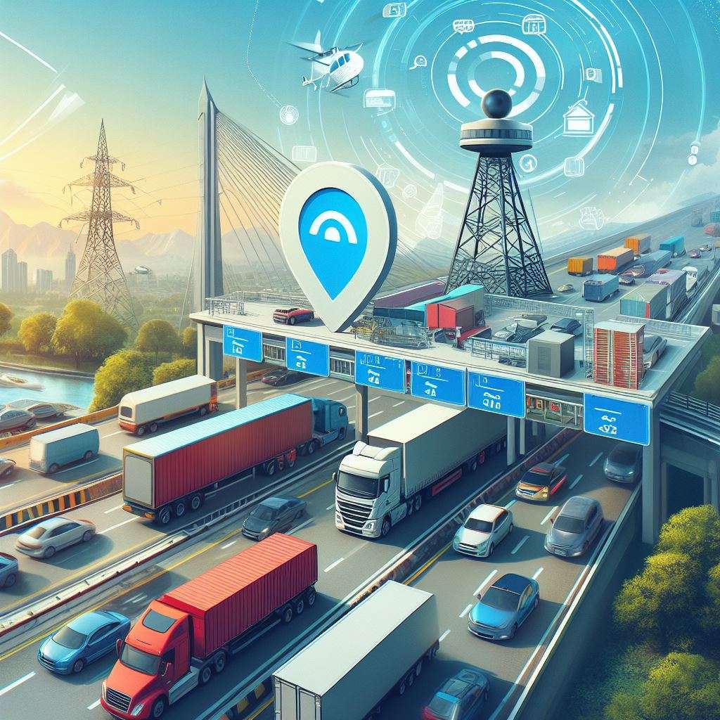
This new system will utilize Global Navigation Satellite System (GNSS) technology to monitor vehicles and calculate toll fees based on the actual distance traveled on national highways.
How the System Works
1. Technology Utilization: The new toll collection system will leverage Global Navigation Satellite System (GNSS) technology. This technology allows for precise tracking of vehicles as they travel on national highways. Unlike the FASTag system that relies on Radio Frequency Identification (RFID) technology and requires vehicles to stop at physical toll booths, the GNSS-based system enables continuous monitoring of vehicle movements without any need for stops.
2. On-Board Units (OBUs): Vehicles will be equipped with On-Board Units (OBUs), which are devices that track their location using satellite signals. These units will calculate the distance traveled on highways in real-time. As a vehicle moves through designated toll zones, the OBU communicates with satellites to determine how far the vehicle has traveled.
3. Distance-Based Charging: The toll charges will be calculated based on the actual distance driven rather than a fixed fee at specific points. This means drivers will only pay for the kilometers they cover on national highways. For instance, if a driver travels 50 kilometers on a highway, they will be charged only for those 50 kilometers.
4. Automatic Payment Deduction: Once the distance is calculated, the appropriate toll amount will be automatically deducted from the driver’s linked bank account or digital wallet. This seamless payment process eliminates delays associated with manual transactions at toll booths.
5. Initial Implementation Phase: The rollout of this system will occur in phases, beginning with commercial vehicles such as trucks and buses before expanding to private vehicles. This phased approach allows authorities to address potential technical issues early in implementation.
Ref:
- India is set to revolutionize its highway toll collection system by introducing a GPS-based tolling mechanism starting May 1, 2025 [https://timesofindia.indiatimes.com/life-style/travel/news/no-fastag-no-stops-india-to-launch-gps-based-toll-system-from-may-1-2025/articleshow/120334862.cms ].
- The upcoming GPS-based toll collection system employs Global Navigation Satellite System (GNSS) technology [https://www.hindustantimes.com/business/no-toll-plazas-anymore-heres-all-you-need-to-know-about-gps-based-toll-system-101725962190554.html].
- The new satellite toll system calculates charges per kilometer using satellite tracking [ https://www.rajarshicollege.co.in/?p=54526].
- Charges are automatically deducted from a linked account through a payment gateway [https://www.financialexpress.com/auto/news/satellite-based-gps-highway-toll-collection-to-start-this-month-says-gadkari/3811071/ ].
- The National Highways Authority of India (NHAI) will oversee this phased rollout [https://timesofindia.indiatimes.com/life-style/travel/news/no-fastag-no-stops-india-to-launch-gps-based-toll-system-from-may-1-2025/articleshow/120334862.cms ].
While this advancement promises numerous benefits such as reduced congestion and enhanced efficiency, it also comes with several drawbacks that need to be considered.
Despite the promising benefits of the GPS-based toll system, there are several concerns and drawbacks that have been raised by critics. One of the main issues is the high costs associated with implementing and maintaining the GPS trackers on vehicles.
Moreover, there are concerns about privacy violations as the government would have access to real-time tracking data of vehicle movements. Critics argue that this level of surveillance could infringe on the privacy rights of citizens and raise potential security risks. Additionally, there have been questions raised about the accuracy of GPS tracking, with the possibility of false toll deductions for vehicles that are not actually using the designated roads.
Disadvantages of India’s GPS-Enabled Toll System
- Privacy Concerns: Continuous tracking raises significant privacy issues as it allows authorities to monitor individual travel patterns extensively. Many users may feel uncomfortable with their movements being recorded and analyzed.
- High Initial Costs: The requirement for each vehicle to have a GPS device can impose substantial costs on owners, potentially running into thousands of rupees. This financial burden could deter some users from adopting the system.
- Technical Reliability: The system’s effectiveness relies heavily on technology; any technical glitches or signal disruptions can lead to incorrect billing or failure to charge users appropriately.
- Complex Billing Issues: Determining charges based on distance traveled can lead to complications, especially if vehicles are transported (e.g., on flatbed trucks) or if there are discrepancies in route tracking due to poor GPS accuracy.
- Potential for Increased Fees: There is concern that governments could exploit this system by easily adding more roads to the toll network without public consent, leading to higher overall costs for drivers.
- Cybersecurity Risks: Directly linking bank accounts increases vulnerability to cyberattacks and fraud, raising concerns about unauthorized access and potential financial loss.
- User Acceptance Challenges: Many drivers may resist transitioning from traditional methods like cash payments or existing electronic systems (e.g., FASTag) due to unfamiliarity with new technology or concerns over reliability.
- Enidhi.net – https://www.enidhi.net/2022/05/gps-based-toll-more-disadvantages-than.html
- LinkedIn – https://www.linkedin.com/pulse/gps-based-systems-future-toll-collection-digisamaksh
- Bridge Masters Inc – https://bridgemastersinc.com/the-pros-and-cons-of-cashless-toll-system/
- Times of India – https://timesofindia.indiatimes.com/technology/tech-news/7-advantages-and-disadvantages-of-satellite-based-toll-systems/articleshow/111036467.cms
- Paytm Blog – https://paytm.com/blog/fastag/gps-based-toll-collection/
- THE PROS AND CONS OF CASHLESS TOLL SYSTEM – https://bridgemastersinc.com/the-pros-and-cons-of-cashless-toll-system/
More Limitations of India’s Toll System Utilizing GPS Technology:
1. Several thousand additional expense for each car owner:
Already 600 Rs is taken from all vehicle owners for fastag. Don’t think a single penny will be returned. On top of it vehicle owners will be forced to shell out thousands of rupees for GPS tracker. Typical GPS devices cost around 3000 INR. Govt will give contract to some company, who will have monopoly so they will charge more.
2. GPS Maintenance charges
GPS device may need battery, might involve maintenance, replacement- so how much extra burden on vehicle owners because of this- not yet clear. But for sure this will consume more time and effort to keep GPS device in good condition.
3. How to prevent double charging?
Let us say your car is put on a flatbed truck and being taken to a garage. In current scenario the truck has to pay a toll at the toll booth and car goes free as car is just a cargo and not using the road. How will this work in GPS system? In my guess both car and truck will be charged money as GPS system can’t understand that the car is on the truck.
4. Risk of every road becoming toll road…
Today if you wish to collect toll fee you have to set up a toll booth. People will notice and protest if too many toll booths are created. if every road is to be tolled when why collect road tax with vehicle purchase? With GPS based system, every day a new road can be added to the toll system and people will have no option to protest or object. Govt will find it very easy to add another road to list of toll roads or silently increase the fee from 3 INR to 5 INR without taking any consent from consumers, without giving them any choices. So it will lead to day light robbery.
5. Privacy issues:
Govt can continuously track any vehicle owner through GPS. This could breach people’s privacy. Govt will eventually use data to its advantage- like if data shows everyone is going to the beach on the weekend, suddenly the toll rate for roads leading to the beach could be increased for the weekend.
6. More speeding tickets
GPS data will result in serious privacy issues. It will also be used to issue speeding tickets. Out of 100 kms journey, 10 kms I drove at 120 kmph because road was empty and it was safe to go fast- speeding ticket comes home. Remaining 90 kms I couldn’t even cross 50 kmph due to bad roads, traffic etc and wasted lots of my time- who will compensate for this?
7. Delay in billing will impact commercial vehicles
Will a taxi driver get GPS Toll fee immediately so that he can get it from customer? If the report takes its own sweet time, how taxi operators are supposed to recover it from customers? Let us say out of 50 kms taxi ride, 10 kms were free road, 10 kms charged at 3 INR per km, 20 kms charged at 4 INR per km, 10 km at 1 INR per km. Ideally as a passenger I need to pay only 30+120+10 = 160 INR extra as toll. But as this information takes time, taxi driver may collect 4 INR per km extra for entire journey and back- 100 km * 4 = 400 INR extra instead of 160. How to ensure this won’t happen?
8. Stolen vehicles
If vehicle is stolen owner still has to keep paying the toll? What is the process to disable GPS?
9. Amount of deduction is not known yet.
Today toll booths charge as high as 5 to 6 INR per km (At Surathkal, 55 INR for 10 kms) to 2-3 INR per km on an average. Same day return is given some concessions.
Today I can calculate my toll expense by knowing how many toll booths I will cross. In future it will be a function of how many kms I drive and on which highway- different roads may have different amount.
10 Build a compensation system first.
If Govt is proceeding with GPS based toll system, first they should implement a satellite based pothole detection and compensation system. If a vehicle owner is forced to negotiate a pothole, he/she should be compensated say 100 INR for the trouble and deduct it from contractor who is not maintaining the road.
Collecting money from people is easy- what about providing service first?
If a road is under maintenance, has potholes, one of the 4 lanes are closed, then toll collection should stop. Does the govt dare to commit to that?
11. Accuracy of GPS will be an issue.
You could be using a service road or a road 200 meters away from the highway. But if GPS thinks you’re using the highway, your money will be deducted.
Where to complain? If money is wrongly debited how to get it back? With no physical office (like toll booth) there won’t be anyone to contact and complain. Money once gone is gone for good.
12. Forced linking to bank account
Not just GPS tracker, Govt will mostly force people to auto link to bank accounts so that money can be directly debited, without consent from vehicle owner. As a citizen I need control whom I pay, how much I pay. If there is unfair charge I need a mechanism to get it back. I can’t assume whatever GPS decides is right.
13. No option to skip toll booth
Today if I am willing to take a detour, I can skip a toll booth by taking a turn, use local roads for several kms and rejoin highway later. Toll booths are strategically set up in locations with no easy alternate options so if vehicle owners take a detour fuel cost will be same as toll cost. But still we have this option if you prefer. But this will be gone with GPS based tracker.
Govt will be saving crores of rupees- now no need to maintain thousands of toll booths, each with 20-30 employees etc. Their salary, cost of maintenance will be saved. But this advantage is not likely to be passed to consumers.
14. Fraud protection
In Fastag, money stays in wallet. If I have added 1000 Rs to my wallet, in case of any fraud, wrong deductions my max risk is this 1000 INR. If GPS tracker is linked to bank account, how to prevent fraud? A fraudster may empty entire bank account in a jiffy. Who will own this risk? Vehicle owners should have a control to maintain a separate wallet or what should be the max amount that can be deducted from their account for GPS Toll.
Fastag has lots of issues, but as usual Govt is not keen to fix them. Govt could have fixed current issues in interstate vehicle usage, but instead they launched a new BH registration system. Let us see how this new GPS toll system works.
Ref: https://www.enidhi.net/2022/05/fastag-toll-system-issues-improvements.html
Toll roads are built with BOT contract- build, operate, transfer- toll operator gets to operate for 10-15 years, recover their investment and then toll is supposed to stop. But no toll booths are closed after their term. Toll companies pay bribe to politicians and authorities and get their contract extended. Can the Govt commit to stop collecting toll money after specific time frame?
Many are of the opinion that this is the expected result
Govt will force this new technology on car owners causing them several thousand rupees in expense
Physical toll booths won’t go away overnight as it will take at least 3-4 years to get India’s 4 crore car owners to install GPS. Rampant corruption will ensure milking maximum money from customers.
Knowing how Govt has rolled out GST, demonetization etc, I don’t think Govt will do any pilot for GPS toll. They will start all India rollout without proper testing, preparation and solution for all scenarios, creating a mess and frustrated vehicle owners. It will take 4-5 years before things can stabilize.
GPS technology operates through a system of satellites, ground control stations, and user equipment. The Global Positioning System (GPS) is a satellite-based navigation system that provides accurate location, velocity, and time information to users anywhere on Earth. It consists of three main segments: the space segment, the control segment, and the user segment.
- Space Segment: This includes a constellation of at least 24 satellites orbiting the Earth at approximately 20,000 kilometers (about 12,500 miles) above the surface. These satellites continuously transmit signals that contain their current position and precise time information derived from atomic clocks onboard. Each satellite orbits the Earth twice daily and broadcasts signals on multiple frequencies (L1, L2, L5) for civilian use.
- Control Segment: This segment comprises ground-based monitoring stations that track the satellites’ positions and health. The control stations are responsible for maintaining the satellites’ orbits by sending commands to adjust their positions as necessary. They also update the navigational data that each satellite transmits.
- User Segment: This consists of GPS receivers found in various devices such as smartphones, cars, and specialized navigation equipment. A GPS receiver calculates its position by receiving signals from at least four satellites. Using a method called trilateration, it determines its distance from each satellite based on the time delay between when the signal was sent and when it was received. By knowing these distances and the locations of the satellites at that moment, the receiver can compute its exact latitude, longitude, altitude, and time.
Main Applications of GPS
GPS technology has numerous applications across various fields, making it an integral part of modern life:
- Navigation: One of the most common uses of GPS is in navigation systems for vehicles (cars, trucks), aircraft, ships, and personal devices like smartphones. GPS helps users find optimal routes to their destinations while providing real-time traffic updates.
- Tracking: Businesses utilize GPS for fleet management to monitor vehicle locations in real-time. This application enhances efficiency in logistics by optimizing routes and improving delivery times.
- Mapping: Surveyors use GPS technology to create accurate maps and conduct land surveys. It allows for precise measurements over large areas without needing physical markers.
- Emergency Services: First responders rely on GPS to locate individuals in distress quickly during emergencies or natural disasters. For instance, emergency services can pinpoint accident locations using mobile phone data.
- Agriculture: Farmers employ GPS for precision agriculture techniques such as soil sampling and crop monitoring. This technology enables them to optimize planting patterns and improve yield efficiency.
- Military Applications: The military uses GPS for navigation in operations involving troops and equipment deployment. The encrypted M-code signal provides secure positioning capabilities resistant to jamming.
- Health & Fitness Tracking: Wearable devices like smartwatches use GPS to track physical activities such as running or cycling by measuring distance traveled accurately
- Geofencing: Businesses implement geofencing technologies powered by GPS to create virtual boundaries around specific areas for marketing purposes or security alerts when individuals enter or exit those zone
Ref:
- Understanding how GPS works [ https://www.geotab.com/blog/what-is-gps/]
- Overview of Global Positioning System [https://novatel.com/support/knowledge-and-learning/what-is-gps-gnss ]
- How does GPS work? [ https://www.faa.gov/about/office_org/headquarters_offices/ato/service_units/techops/navservices/gnss/gps/howitworks]
- Applications of GPS technology [ https://www.spiceworks.com/tech/iot/articles/what-is-gps/]
- Fleet management with GPS [ https://www.geotab.com/blog/what-is-gps/ ]
- Mapping with GPS technology [https://novatel.com/support/knowledge-and-learning/what-is-gps-gnss]
- Emergency services using GPS [https://www.geotab.com/blog/what-is-gps/]
- Agriculture applications of GPS [ https://novatel.com/support/knowledge-and-learning/what-is-gps-gnss ]
- Military uses of GPS [ https://www.faa.gov/about/office_org/headquarters_offices/ato/service_units/techops/navservices/gnss/gps/howitworks ]
- Health tracking with wearables [ https://www.spiceworks.com/tech/iot/articles/what-is-gps/]
- Geofencing applications powered by GPS [ https://www.spiceworks.com/tech/iot/articles/what-is-gps/]
Additional information:
Bill Gates and Satellite Initiatives in India
Bill Gates has expressed significant interest in the advancements of satellite technology and its applications in India. His remarks highlight the potential of satellites to address various global challenges, particularly in health, agriculture, and disaster response.
Praise for India’s Space Technology
In a recent conversation, Gates praised India’s burgeoning space technology sector, noting its contributions to affordable satellite solutions. He emphasized that India is making strides with numerous startups focused on developing low-cost rockets and satellites. This innovation is crucial as it allows for enhanced capabilities in areas such as weather monitoring and agricultural observation, which can have substantial benefits for both local and global communities. Gates remarked on how satellite data could be leveraged for development purposes, particularly by organizations like the Gates Foundation, which aims to utilize this information to improve lives.
The Role of Satellites in Global Health
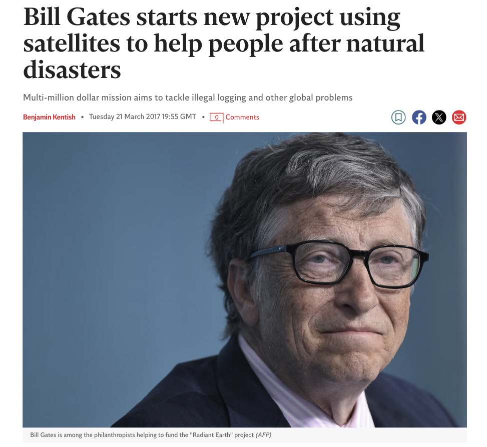
Gates has been involved in initiatives that utilize satellite data to tackle pressing issues such as health crises. For instance, he co-founded the “Radiant Earth” project aimed at sharing satellite imagery to help manage global challenges like illegal logging and disaster response. This initiative underscores his belief that satellite technology can play a pivotal role in humanitarian efforts by providing critical data that can inform decision-making processes during emergencies.
Collaboration with Indian Innovators
During his visits to India, Gates has highlighted the importance of collaboration between the Gates Foundation and Indian innovators. He noted that India’s digital public infrastructure (DPI) is exemplary and serves as a model for other countries. The integration of AI with satellite data is seen as a transformative approach to improving healthcare delivery and agricultural practices. For example, AI-powered tools are being developed to assist rural health workers in early disease detection and management.
Future Prospects
Looking ahead, Gates envisions a future where advancements in satellite technology will continue to enhance various sectors within India. He believes that these innovations not only benefit India but also have the potential to be shared globally, thereby addressing challenges faced by other nations. The ongoing development of low-cost diagnostics and vaccines—facilitated by insights gained from satellite data—could significantly impact global health outcomes.
Ref:
- Bill Gates praises India’s affordable space solutions. [https://www.timesnownews.com/india/cheap-rockets-satellites-bill-gates-hails-indias-affordable-space-tech-boom-exclusive-article-119283234]
- Bill Gates starts new project using satellites to help people after natural disasters. [ https://www.independent.co.uk/news/science/bill-gates-melinda-gates-gates-foundation-satellites-radiant-earth-project-seattle-a7642206.html ]
- Bill Gates praises India’s digital innovations for global health impact. [ https://www.indiatoday.in/india/story/bill-gates-praises-india-digital-innovation-contribution-global-health-ai-infra-2695982-2025-03-19 ]
- Bill Gates emphasizes India’s role in advancing scalable solutions for global challenges. [https://www.livemint.com/news/us-news/bill-gates-praises-india-s-success-in-health-tech-and-ai-ahead-of-visit-11742071567538.html]
Use of GPS Technology in Polio Eradication
The Bill & Melinda Gates Foundation is utilizing GPS technology to help stamp out polio by tracking small communities that are missing out on vaccinations.
Tracking Vaccination Efforts
The primary challenge in eradicating polio lies in ensuring that every child receives the necessary vaccinations. In some remote or underserved communities, children may miss out on these critical immunizations due to logistical issues or lack of access. To address this, GPS technology is utilized to map out areas where vaccination coverage is low. By employing geographic information systems (GIS), health workers can identify specific communities that have not received adequate vaccinations.
This mapping allows for targeted interventions. For instance, if a particular village is identified as having a low vaccination rate, health officials can organize special vaccination drives to ensure that all children receive their doses. This data-driven approach helps optimize resource allocation and ensures that no child is left unvaccinated.
Real-Time Data Collection
In addition to mapping, GPS technology facilitates real-time data collection during vaccination campaigns. Health workers equipped with mobile devices can log information about which children have been vaccinated and which have not. This immediate feedback loop allows for quick adjustments to be made during campaigns, ensuring that efforts are focused where they are most needed.
Moreover, using GPS coordinates helps track the movement of vaccination teams and monitor their progress throughout different regions. This level of oversight enhances accountability and ensures that teams adhere to their schedules and reach all designated areas.
Collaboration with Local Governments
The implementation of GPS technology in vaccination efforts also involves collaboration with local governments and health organizations. By sharing data collected through these technologies, stakeholders can work together more effectively to combat polio. This collaborative effort is crucial in regions where political instability or logistical challenges may hinder public health initiatives.
Ref:
- “How GPS Technology Is Helping Fight Polio.” [https://www.gatesfoundation.org/]
- “Polio Eradication Initiative.” [ https://www.who.int/]
- “Using GIS for Public Health.” [ https://www.cdc.gov/ ]
GPS data is primarily stored in onboard memory within devices or transmitted to cloud-based systems for real-time access, allowing users to track movements accurately and efficiently.
How is GPS Data Stored?
GPS data is stored in various formats depending on the type of device and its intended use. The storage methods can be broadly categorized into two main types: onboard memory within the GPS device and external storage solutions such as cloud services or local databases.
- Onboard Memory: Most GPS devices, including handheld units and vehicle navigation systems, have internal memory where they store location data. This onboard memory can include:
- Waypoints: Specific locations saved by the user.
- Tracks: A series of points representing a device’s movement over time.
- Routes: Planned paths between multiple waypoints.
- Geotags: Location metadata embedded in photos or other files.
The amount of data that can be stored depends on the device’s specifications. For example, a typical twelve-channel dual-frequency receiver observing six satellites with a one-second epoch interval over an hour would require approximately 2MB of storage capacity.
- Data Logging: Some GPS devices are designed to log data for later retrieval. These passive devices store location data locally on memory cards or onboard memory, which can be downloaded and analyzed later. This method is commonly used in applications like wildlife tracking or logistics, where historical location data is essential.
- Cloud Storage: Many modern GPS tracking devices utilize cloud services to store their data. This allows for real-time access to location information from anywhere with internet connectivity. The data is transmitted via cellular networks or Wi-Fi to a central server, where it can be accessed through web interfaces or mobile applications.
- Data Formats: The stored GPS data may be encoded in various formats, such as NMEA (National Marine Electronics Association) sentences, which are standard formats for transmitting navigational information from marine electronics. Other proprietary formats may also be used depending on the manufacturer.
- Data Retrieval and Analysis: Once the GPS data is stored, it can be retrieved for analysis using specialized software tools that decode the stored information into human-readable formats like latitude and longitude coordinates along with timestamps. This process often involves converting raw binary data into usable insights for applications ranging from navigation to forensic investigations.
Ref:
- Most GPS receivers today have internal data logging… [ https://www.e-education.psu.edu/geog862/node/1790]
- Passive devices simply store location data… [ https://zenduit.com/how-do-gps-tracking-devices-work/]
- The device then sends this information to a central server… [https://zenduit.com/how-do-gps-tracking-devices-work/]
- Each GPS satellite transmits signals that contain timing and positioning information… [ https://www.provendata.com/blog/what-is-gps-forensics/]
- After extraction, the raw GPS data must be processed and analyzed… [ https://www.provendata.com/blog/what-is-gps-forensics/]
Source: Corona Today-Image, Linkedin-Image
Also Read: